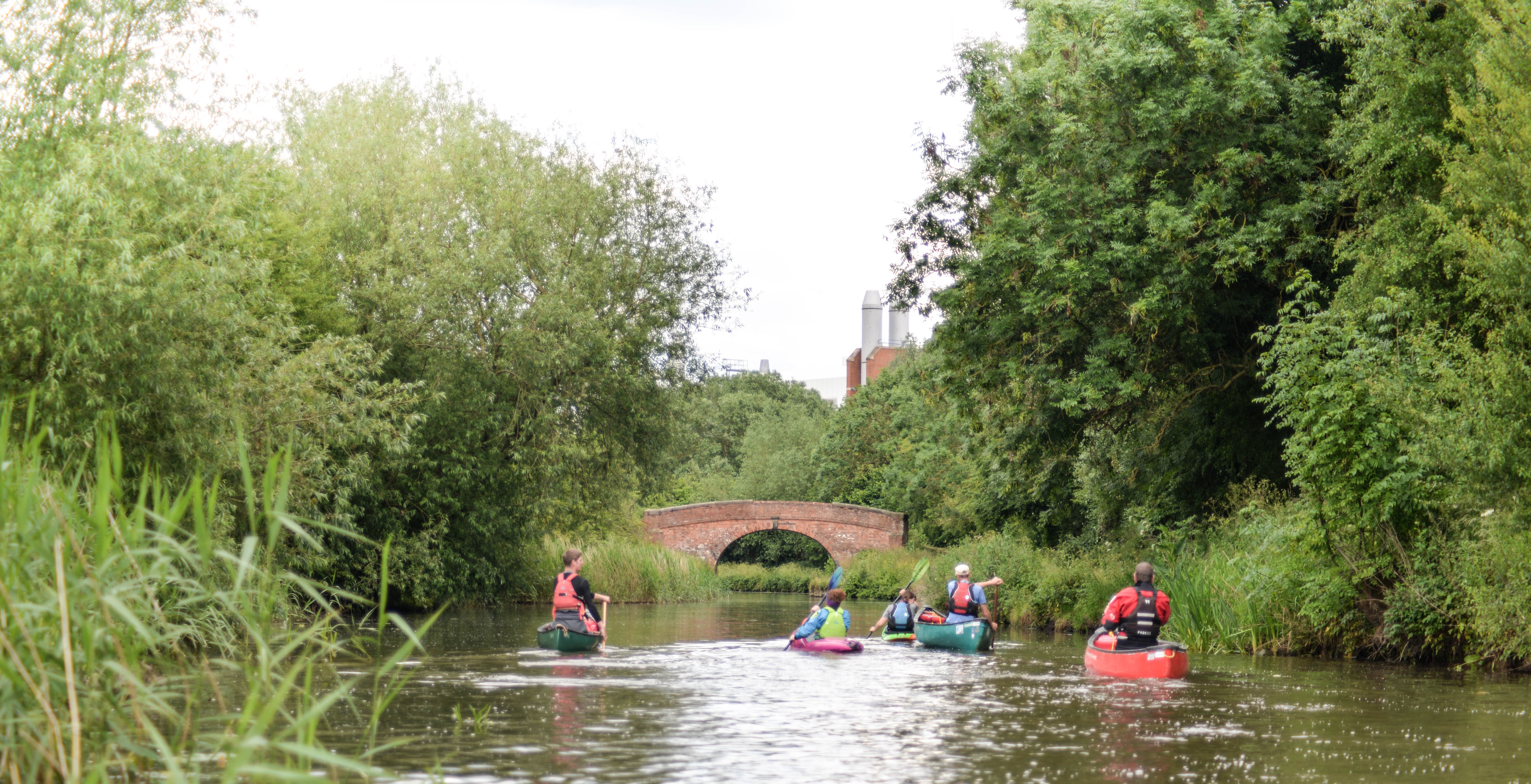
 Aproaching the Science Park, Loughborough
Aproaching the Science Park, Loughborough
Aproaching the Science Park, Loughborough
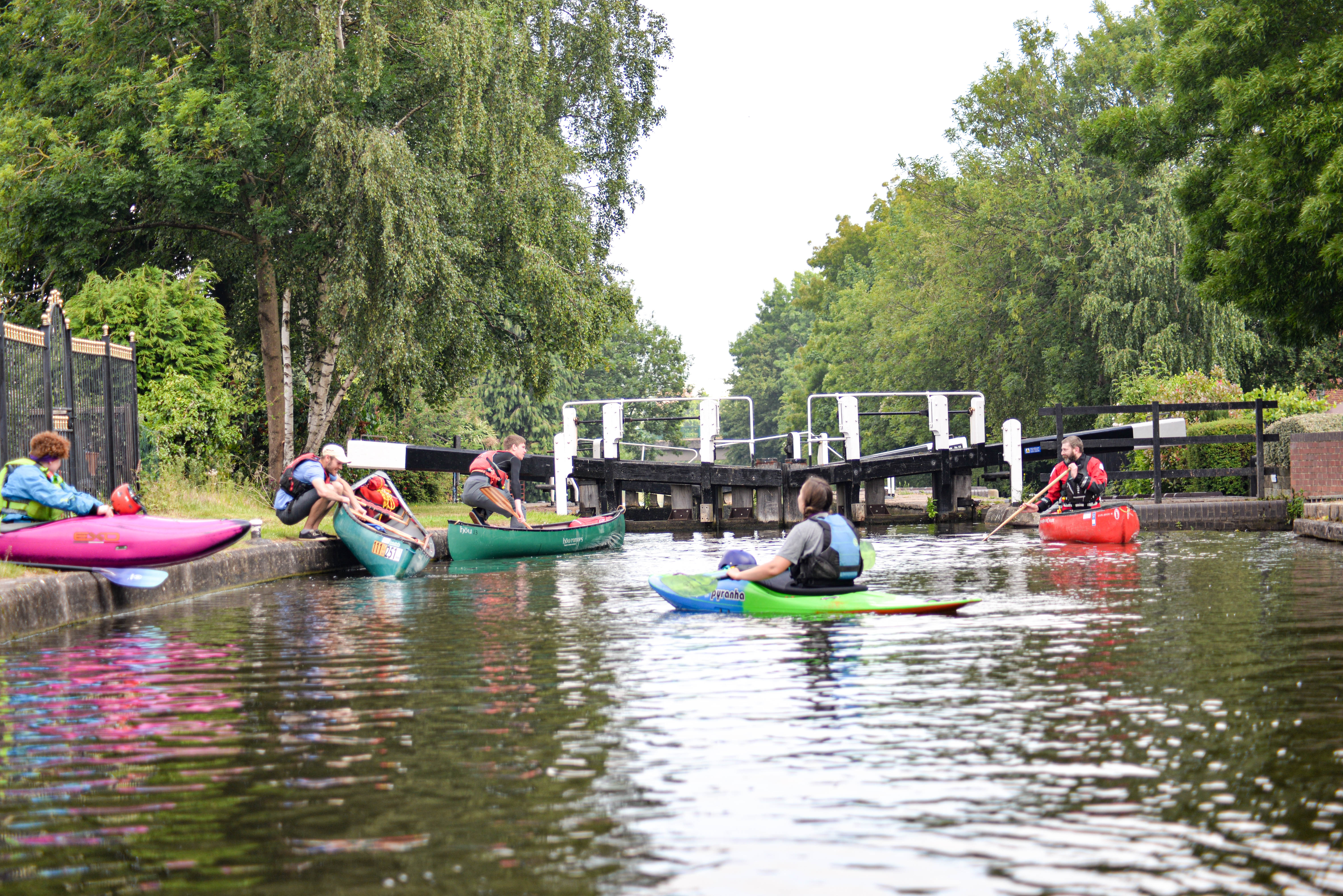 Portaging Loughborough Lock
Distance: 8.7 miles (14km)
Time to complete: 4hrs
Difficulty: Moderate
Portages: 1
Locks: 2
Weirs: 1 small
Gauge readings: Pillings 2142
Requires reasonable water levels (.9m)
Swingbridge Road start
Map reference: SK529201
Post Code: LE11 5QS
Alternative starts
The Boat Inn, Meadow Lane
Map Reference: SK539204
Post Code: LE11 1JY
Moor Lane
Map Reference: SK547193
Post Code: LE11 1SH
The Mooringings, Barrow upon Soar
Map reference: SK573174
Post Code: LE12 8PN
This start adds 2 miles to route
 Link to route in PaddlePoints
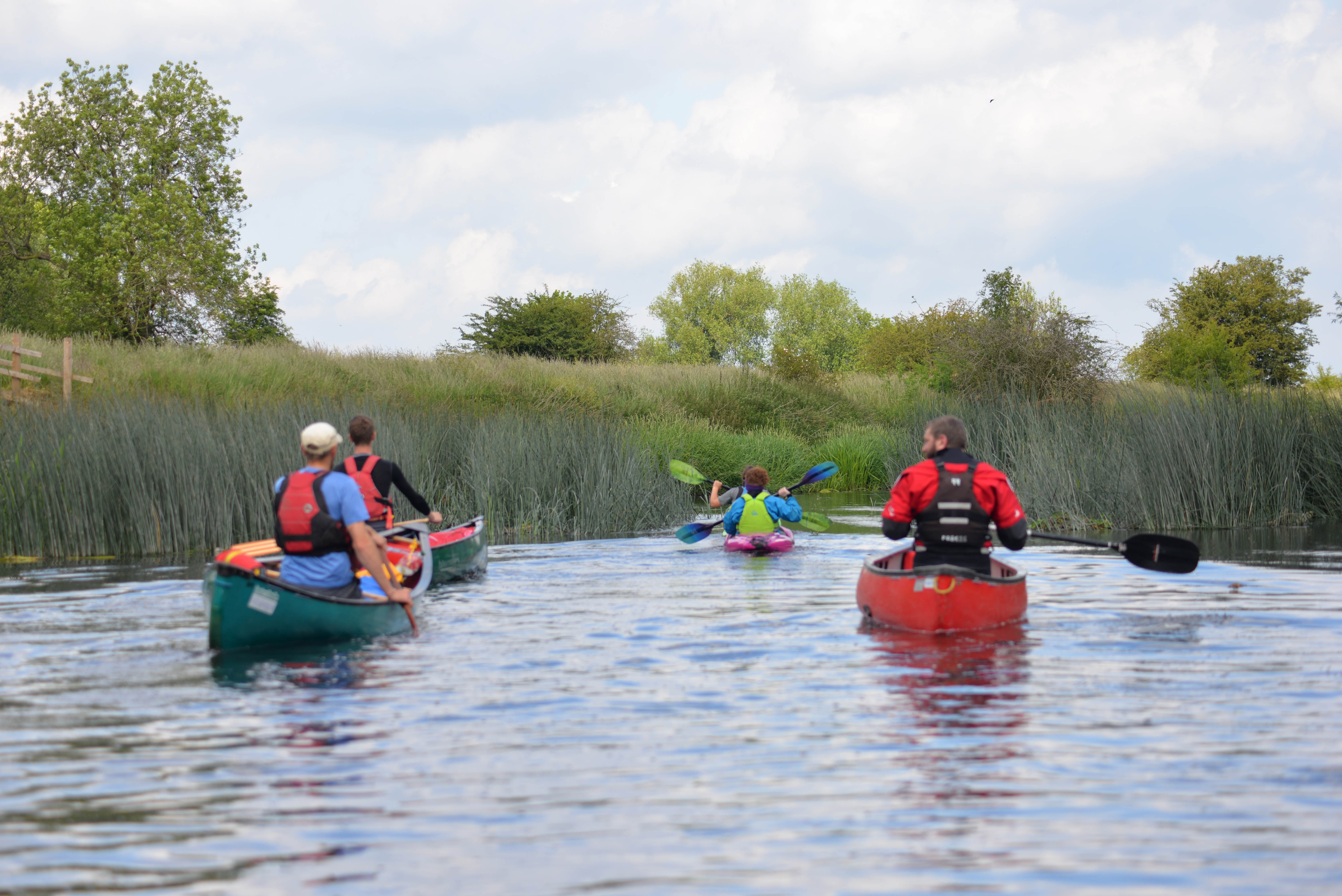
 Starting from the Swingbridge Road this trip takes you through Loughborough on the canal to Pillings lock for a short portage on to the River Soar. There follows one of the prittyest stretchs of the Soar as it meanders towards Normanton. Rejoining the canal at the Science Park.
Starting from Swingbridge Road reduces the length of canal to paddle at the end of the circular trip. There is space to unload on the far side of the humped back bridge but parking for the trip should be on the small industrial estate to avoid vehicles being a problem to other users. The field at the back of the tow path has banks of solar panels that help Severn Trent's sewage treatment plant keep to their pledge of self-sufficiency. Set off south towards the town, within 600m is the first of two locks, portaging on the right opposite the tow path offers a grassed passage out of the way of cyclists and other users. Continue under the main A6004 Belton Road bridge towards the junction. Just after the bridge is a small aqueduct over the Wood Brook; it is designed with spillways on both sides to shed surplus water from the canal back to the river across the meadows. 500m from the lock the canal turns sharp left under an arched bridge. Continuing forward takes you to the redeveloped canal basin at the heart of the town. Going under the arched bridge to continue the journey on the Grand Union, along a stretch of back gardens and flats to the right.
 The Boat Inn, Mat Fascione
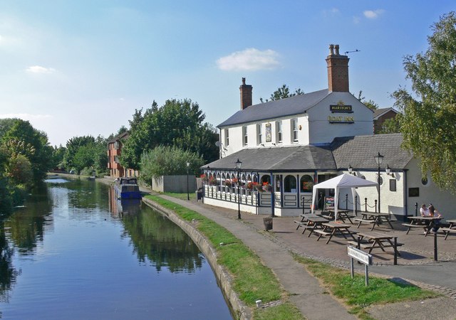
Just before the next bridge is The Boat Inn. A little early in the trip, but unfortunately the only pub left on the circular route; an early morning coffee may be the order of the day. Alternatively, you could arrange with the landlord to start here and be looking forward to finishing with a drink and food. The Boat Inn is next to Meadow Lane bridge which is followed, 400m on, by Nottingham Road bridge. On the Loughborough side of the bridge is a house with a basement below the bridge, opening onto the tow path.
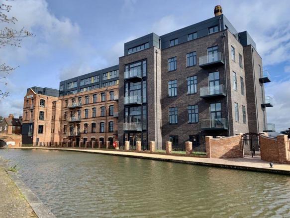 Waterside Village, Solus Homes
On the far side of the bridge is Morley's hosiery mill built in the 1890s. In the early 1950s it became one of 3M's factories in Loughborough; they relocated and consolidated in 2019 to the Charnwood Campus two miles away on the Science Park. Since then it has been redeveloped as a "Waterside Village" of smart warehouse apartments. This stretch of the canal leading out of Loughborough has seen a lot of repurposing of the former industrial heritage that the waterway supplied the transport links for, prior to the railways. Most of the decaying and derelict industrial buildings and wasteland have been replaced with waterside housing developments with the canal now providing amenity and attraction. There are great examples of sympathetic development that preserve the shape of the former history.
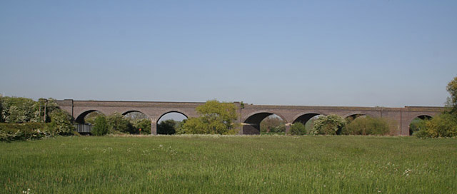
 Great Central Railway referbished bridge
The next bridge is the newly refurbished Great Central Railway bridge crossing from the station to the embankment of the former track a tantalising 500m of missing track that would link the social enterprise heritage railway to the national rail network. The reunification project has made great strides but has a way to go to achieve its aim. Next are two humped back bridges giving access to the Loughborough Moors. This area of 46 hectares of meadow land and flood plain between the canal and the river is managed by Leicestershire and Rutland Wildlife Trust. Space to park and launch is available at both of these bridges. On the right as you head out into open countryside is the moorings for the Peter Le Marchant Trust who run a fleet of wider access canal boats. Next to them is the base for Loughborough Sea Cadets.
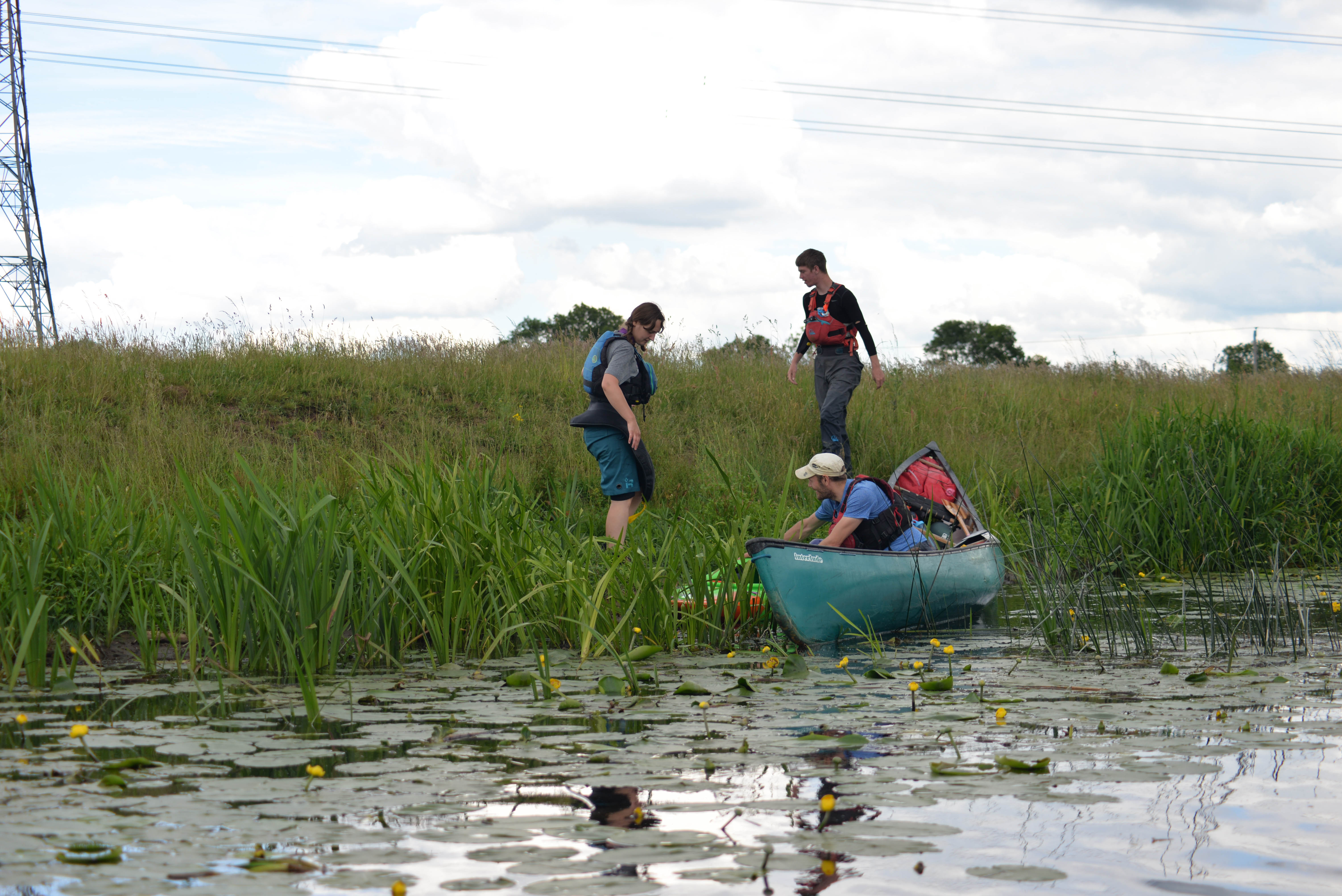
A mile of open fields under three further arched bridges follow. After Top Bridge look out on the left for a foot bridge under the railway at the end of a coppice of trees. This is the portage point between the canal and river. The route is under the active Midland Main Line railway to land managed by the Scouts and used by anglers. There are various "pegs" to relaunch onto the river; most having a fixed wooden pallet. Please be respectful when relaunching.
 Launching onto the Soar at Pillings, Andy Oughton
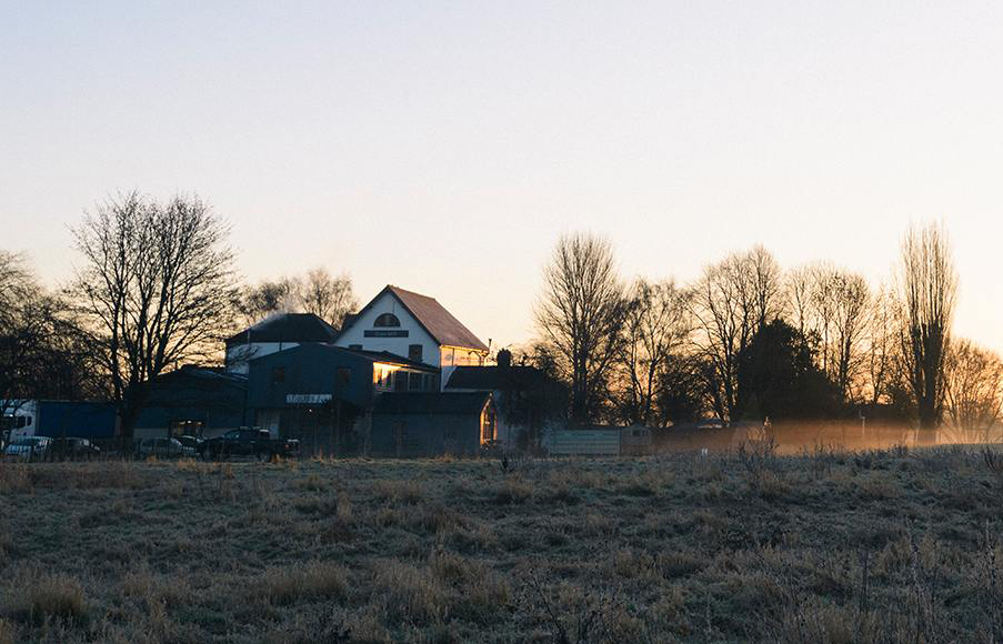
The following 4 plus miles are the best the Soar has to offer (in my opinion) reeds, wildlife, riffles, open countryside and the occasional train. After almost 2 miles from launching on the river is a sharp righthand bend, then Cotes Mill can be seen on the left bank. This is the remaining one of two mills at this site although the Doomsday Book of 1085 makes mention of a mill at this site. The Upper Mill (remaining) was named the last working mill in Leicestershire, closing in 1973. It is now the home of stylish kitchen company deVOL and a herd of deer!
 Cotes Upper Mill - deVOL
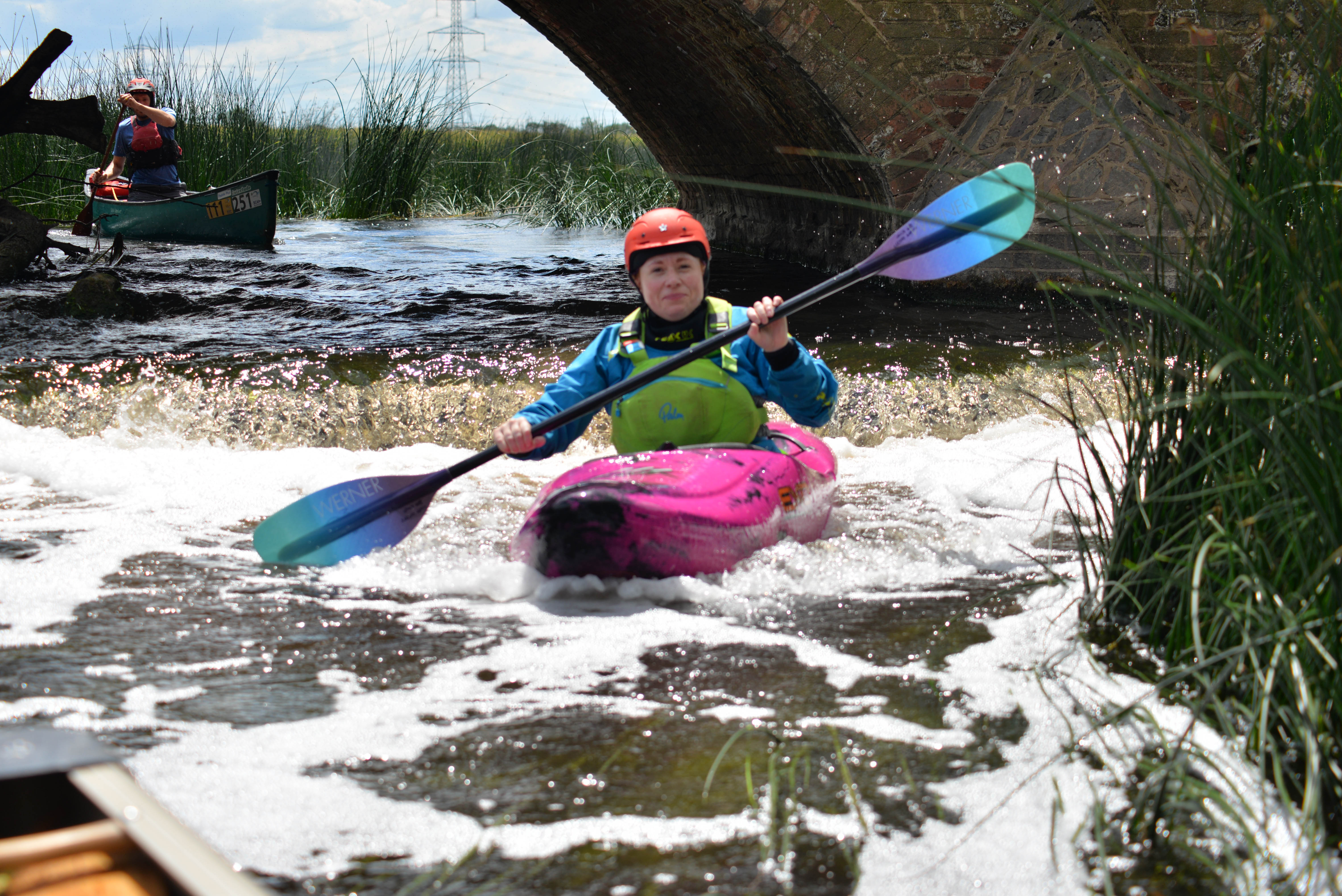 Kayaker at Cotes Bridge - Andy Oughton
Cotes Bridge is approached through a reedbed with flow channels. The left hand or centre arch give passage over a small step clad in Armco. It is possible at most levels to step out of your boat under the middle arch onto the concrete bridge base and lower your boat over the Armco to avoid any chance of damage on the lip. Portaging is problematic as there is no easy exit point ahead of the bridge and the road is busy.The bridge is the site of a two day battle during the English Civil War between the Royalist forces based in Loughborough and the Parliamentary General Hartopp from Newark. The Royalists won and went on, with Prince Rupert, to relieve Newark.
Beyond Cotes Bridge the river meanders first left and then right. On the outside of the righthand bend a barbed wire cattle fence encroaches into the river which requires caution to pass. Paddling through the wide flood plain of Loughborough Meadows continues until you reach Stanford Island one mile on from the Cotes Bridge. Stanford Church tower can be seen over the fields away to the right. There is a footpath that crosses the island. It provides a great place to stop for refreshments. To the right the river goes under the foot bridge and over a shallow ford and continues quite shallow until it re-joins the left-hand channel, which is the more interesting, flowing over a little rock riffle. To the left after this a channel enters that was once the head of Loughbrough Navigation finishing by the station. This was an early atempt to make the Soar navagable from Trent Lock. The river continues under a footbridge and down a stretch of faster flowing water. The two channels converge at the Stamford Viaduct which carries the Great Central Railway (Ruddington branch) over its eleven arches at a gradient of 30 feet per mile.
 Loughborough Viaduct - Alan Murray-Rust
Meadow Lane road bridge follows before another stretch of gentle flowing river through the traditionally managed Bishop's Meadow. The relatively straight flow of the river 'buckles' just before the entrance to the canal and in the field above the right-hand bank is an example of an oxbow lake with a line of trees and a wet indentation signalling the earlier course of the river.
 Looking for an Oxbow Lake - Andy Oughton
The Soar continues to the right towards Normanton; the church spire is evident from this point. The loop continues by turning left into the canal cutting, towards the prominent landscape of the Science Park nicely juxtaposed by the traditional arched brick canal bridge. Shortly after entering the cut is Bishop's Meadow Lock. Regrettably, there is a high banked get-out on the right, eased slightly by a wooden bump plate and guard rails to grab hold of. In the fullness of time it is hoped to have a platform to the left to ease egress at the lock. Above the lock is the last 200m of the paddle, back to Swingbridge Road past a line of residential moorings.
We'd love to hear from you if you have done this paddle,
spotted a correction or just want to say hello!
© Copyright Andy Oughton, Soarpaddler 2015